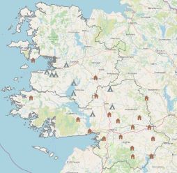
Ice houses and Sweathouses in Mayo and Galway
We used this data set for an assignment in semester 1 of the GIS1 module
Within the ice house data there were 44 recorded features. In order to save space,
I chose to choose a subset of the data and selected only those present in Galway and Mayo, where there were 19 located.
Within the sweat house data there were 232 recorded features. In order to save space,
I chose to choose a subset of the data and selected only those present in Galway and Mayo, where there were 10 located.
Within the shapefiles attribute tables there was little information. I chose to display the townland in which the structure was located as a pop up for the point on the map.
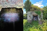
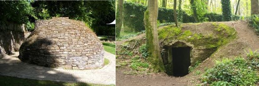
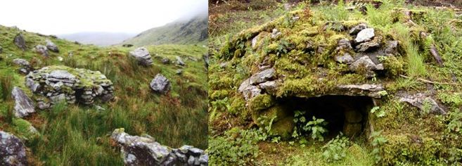
Ice houses
These ice houses were the cold rooms of by-gone days which were used for keeping meat and fish in storage over time. They were
located close to lakes and ponds where ice could be collected and used in the cooling process for food preservation.
An ice house, or icehouse, is a building used to store ice throughout the year, commonly used
prior to the invention of the refrigerator. Some were underground chambers, usually man-made,
close to natural sources of winter ice such as freshwater lakes, but many were buildings with various types of insulation.
In 1985, a passage was discovered beneath Ardgillan Castle in Co. Dublin, Republic of Ireland. This passage was
found to be the ice house that had been known to exist on the grounds, but whose location had not been rediscovered until this date.[15]
There are other ice houses still surviving in Ireland, for example on the Woodstock Estate near Inistioge,
Co. Kilkenny and at the former Rockingham Estate in Boyle, Co. Roscommon, now accessible at Lough Key Forest Park.
Images of Ice houses
Click to enlarge
×
![]()
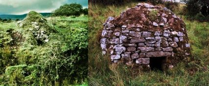
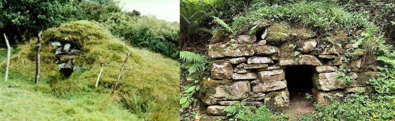
Sweat houses
A Sweathouse was a type of early sauna, used in Ireland in the 18th and 19th centuies, but its origins may date back much further.
This unusual dry-stone structure was used to cure fevers and pains up to the end of the 20th century,
and many similar sites around the country were built in the 18th and 19th centuries.
Irish Sweathouses are small, rare, beehive-shaped, corbelled structures of field-stones, rarely more than 2 metres in external height and diameter,
with very small "creep" entrances which may have been blocked by clothing, or by temporary doors of peat-turves,
or whatever came to hand. Most of those which survive could not have accommodated more than three or four sweaters.
They resemble the small 'caves', built into banks, in which many Irish natives were reported to live in the seventeenth century.
Some have chinks to let out the smoke, but they were necessarily
cleared of fire and ash before use - so any chinks (deliberate or otherwise) in the rough construction would have served as
ventilation ducts in a cramped space. Where these were too big, they were stopped with sods or with mortar.
×
![]()
×
![]()
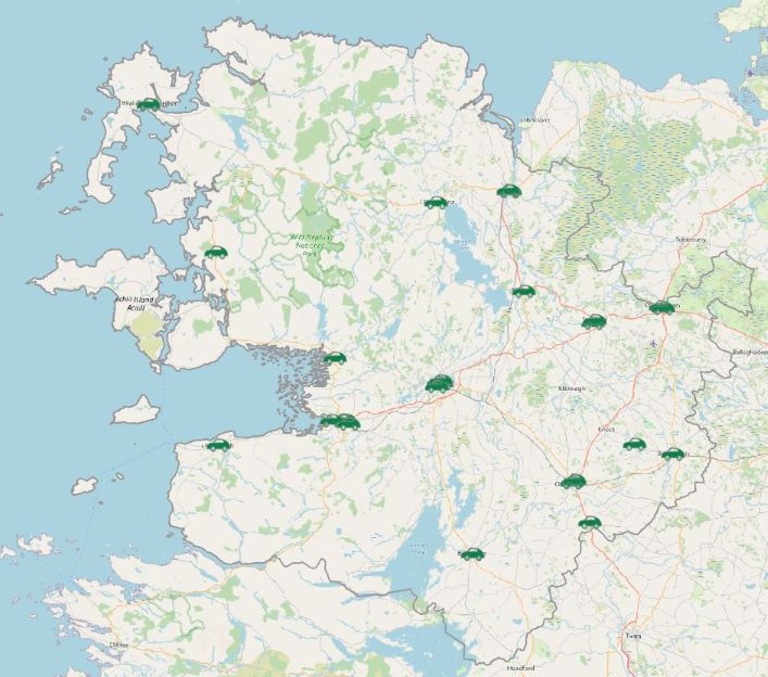
Ice houses and Sweathouses in Mayo and Galway Map
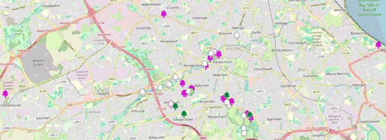
Mergin Blossom Survey
In semester 1 of the course we undertook an assignment to record a dataset using the Mergin Map App.
We were undertaking the survey in March/April 2024. On looking for inspiration for this assignment I was
taken by the beautiful blossoms around me in South Dublin. I love to see the blossoms arriving as it’s a sign that
Spring has arrived and longer evening are on the way.
For my survey I recorded the data, the number of trees in the vicinity, notes on the area, the weather conditions,
the approximate tree height and the status/colour of the blossoms – (pink, white, mixed, pre, post).
For my map I chose to represent the status/colour of the blossoms as this is the most interesting attribute.
Shortly after I undertook my survey there was an act of vandalism which made national news. Someone cut the young trees in
my local park, Dodder Valley Park.
These trees came into bloom after I had undertaken my survey and were not recorded in my assignment.
I am happy to report that the council and local volunteer groups have planted new trees,
I look forward to seeing them in bloom in Spring 2025.
Mergin Blossom Survey Map
About me
I have been working for Inland Fisheries Ireland (IFI) since 2002 on a number of projects, including monitoring fish
and plants on OPW arterially drained channels and water sampling on the canals and waterways of Ireland.
I joined the Habitats Directive and Red Data Book species team in 2009. My role within this team is monitoring the
3 lamprey species, Twaite shad and Pollan. Within this role we use numerous techniques to monitor these species,
these include electro fishing, netting, eDNA, lamprey spawning surveys, shad egg surveys.
My role within the team involves participating in all aspects of field survey monitoring and collection of data.
My speciality is providing the GIS support to the team, with the creation of species density,
distribution and range maps for the team. This year, 2024, is a reporting year. I am largely self taught in GIS
which is why I enrolled in this course.